Development of Conceptual and Numerical Groundwater Models for EIA Studies
Project Description
In 2015, the existence of infiltrations from the Tailings Storage Facility (TSF) near an open pit copper mine was confirmed. This led to a series of hydrogeological studies, both conceptual and numerical, which concluded that infiltration from the TSF had not reached (and, therefore, had not recharged) the regional aquifer.
From 2018, in the framework of the proposed Expansion Project for the TSF and the associated EIA to be submitted, additional studies have been carried out to improve hydrogeological understanding. Itasca Chile SpA (Itasca) was retained to develop a numerical 3D groundwater flow model that would allow the assessment of potential environmental impacts over the aquifer due to the infiltration associated with the expansion of the TSF. Additionally, it was requested to study the potential influence of infiltrations on the mine pit located about 3 km of the TSF.
Itasca's Role
Itasca's work was divided into three phases:
- The hydrogeological conceptual model was updated, including geophysics, hydrochemistry and isotopic data, as well as changes in groundwater levels of wells surrounding the TSF.
- Using SEEP/W, five 2D flow models were developed to estimate infiltration rates and possible aquifer recharge in different sections of the TSF. The results were extrapolated to wet areas of the TSF for each year, which were identified through satellite imagery, allowing thus for the calculation of infiltration flow rates, which were then used as input parameters for the 3D flow model.
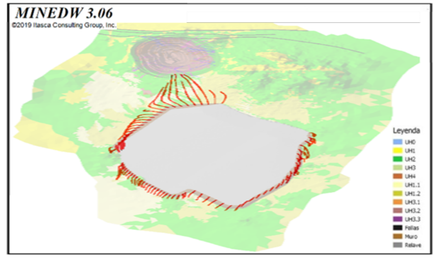
- A 3D groundwater flow model was constructed and calibrated with MINEDW to assess the possible impacts related to the projected expansion.
Project Results
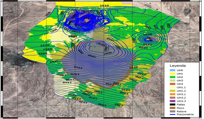
The updated conceptual model corroborates the previously defined hydrogeological units and their hydraulic parameters, defining the hydrogeological medium as a low permeability aquiclude (K = 10-8 to 10-10 m/s) where water moves primarily through structures. At the same time, it is established, in contrast to previous studies, that infiltration from the TSF reaches and recharges the aquifer in the east sector, but not in the west, where the existing infiltration collection system seems to work in an adequate manner. These findings were considered in 2D flow analyzes to estimate infiltration in the historical, current and future stages of the deposit.
The 3D model was calibrated in steady state and transient regimes, with SRMS values of 7.2% and 6.6% respectively, allowing the conceptual model to be reproduced, adequately capturing the changes in water levels observed in the study area. For future scenarios, it was found that the implementation of the expansion of the TSF would be environmentally favorable, reducing infiltration and recharge to the aquifer. This is justified due to deposition in thinner layers and in a larger area, allowing for a higher evaporation of water from the tailings. In addition, it is confirmed that the planned infiltration collection system - incorporated into the predictive numerical model - would greatly control and reduce infiltration, even allowing the regional flow to recover its natural state in the long term.
Project Image(s)


